

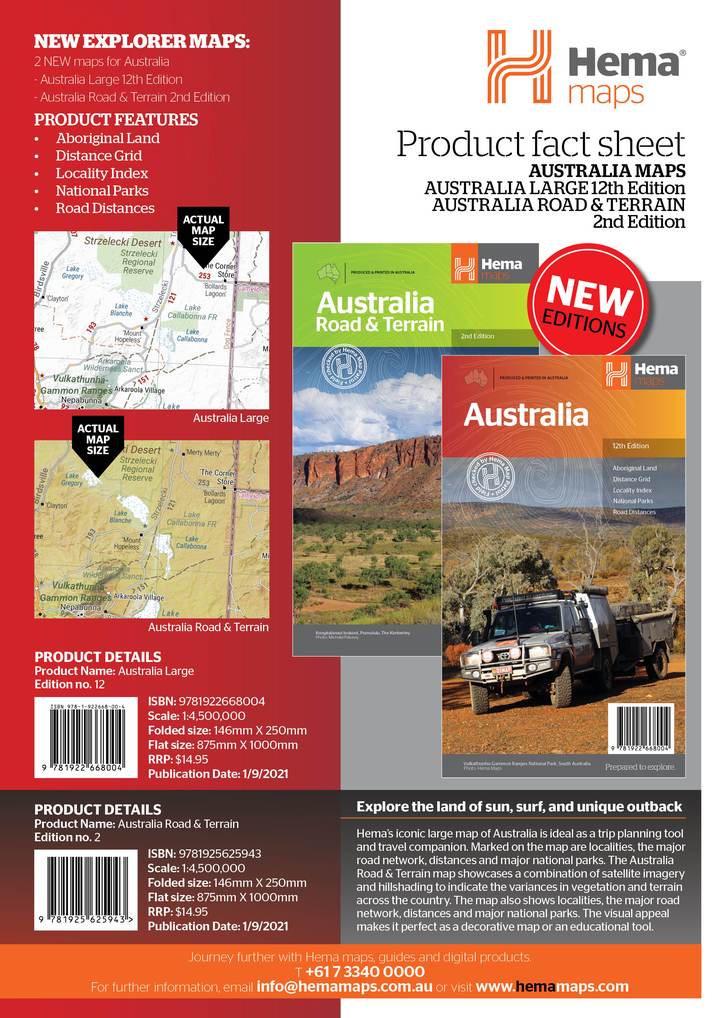
North Queensland Map (11th edition)
This is the ideal North Queensland map for discovering the many destinations between Mackay and The Tip. The mapping is at a touring scale of 1:750,000, with terrain shading and touring symbols giving an accurate and informative overview of the region. There is a detailed inset map for Mackay and the Whitsundays and another for the entire coastal strip between Townsville and Cooktown. There is also tourist information on the popular coastal strip with a handy list of national park facilities and information centres as well.
- Detailed coastal inset map
- Camping areas
- Points of Interest
- National Parks
- Tourist areas
Be the first to review “Hema North Queensland Map 11th Edition”
Related products
Sale!


$18.95
$14.95
Sale!
$16.50
Sale!
$11.98
$14.95
Sale!
$14.98
Sale!
Reviews
There are no reviews yet.